
The Silent Sentinels: Charting America's Past and Future, One Brass Disk at a Time
A Discovery on the Mountaintop
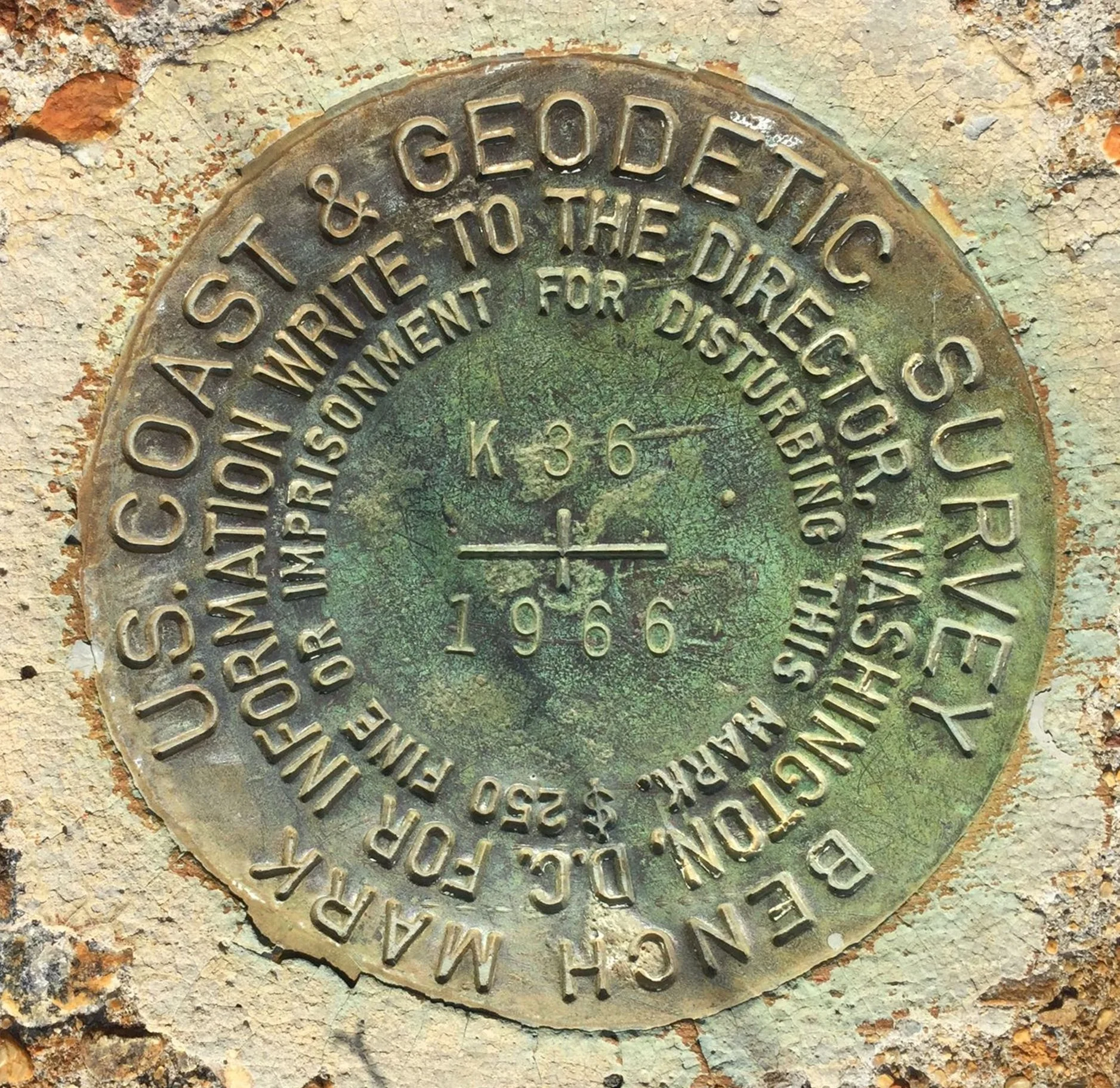
Image from National Geodetic Survey | https://geodesy.noaa.gov/surveys/mark-recovery/index.shtml
The air is thin, the wind a constant pressure against your back. After hours of climbing, you’ve reached the summit, a granite crown on a remote mountain. The world unfolds below in a panorama of ridges and valleys. Amidst this raw, natural beauty, your eye catches something out of place: a small, metallic glint set into the bedrock. You kneel for a closer look. It is a weathered brass disk, no larger than the palm of your hand, its surface greened by a century of sun and snow. Stamped into the metal are cryptic words—"U.S. COAST & GEODETIC SURVEY"—and at its center, a simple, perfect triangle.
What is this object? Who hauled the tools and concrete to this isolated peak, and for what purpose? This humble disk is a geodetic survey marker, and its discovery is a portal to the past. It is a physical anchor to a two-century-long scientific odyssey to measure and map a continent, an epic of ambition, grueling labor, and uncompromising precision. These markers are not mere relics. They are the silent sentinels of a story that built a nation, formed the invisible framework of our modern world, and, paradoxically, remain essential in an age defined by the view from orbit. This is the story of how a network of brass and sweat laid the foundation for the digital age, and how the quest to know precisely where we are continues to shape our future.
Jefferson's Audacious Vision: Mapping a New World
The Problem of an Unmapped Nation
In the early 19th century, the United States was a nation of immense potential and equally immense peril. It was a country defined by its vast, unmapped frontiers. Its coastline, a vital artery for commerce and communication, was a treacherous labyrinth of hidden shoals and inaccurate charts. The existing maps were a dangerous patchwork of incomplete British surveys and error-filled private publications, making every voyage a gamble. Beyond the coast, the interior stretched into a void on the map, a continent waiting to be measured and understood. For a young republic eager to secure its borders, foster trade, and encourage westward expansion, this lack of spatial knowledge was a critical vulnerability.
It was in this context that President Thomas Jefferson, a surveyor himself and a man of profound scientific curiosity, signed into law an act on February 10, 1807, "to cause a Survey to be taken of the coasts of the United States". This was more than a public works project; it was the creation of the nation's first civilian scientific agency, an act of intellectual and commercial self-determination. The new "Survey of the Coast" was tasked with creating the definitive nautical charts that would make maritime activity safe and predictable.
Enter Ferdinand Hassler
To lead this monumental undertaking, Jefferson sought the best scientific mind he could find. The American Philosophical Society invited proposals, and the most compelling plan came from Ferdinand Rudolf Hassler, a brilliant, passionate, and notoriously uncompromising Swiss geodesist who had immigrated to America seeking a grand challenge. Hassler’s vision for the survey was as audacious as it was controversial.
Where Congress and the shipping industry wanted quick, practical maps, Hassler proposed something far more profound. He argued that before a single shoreline could be accurately charted, a "geodetic skeleton" must first be built. This would be a rigid, continent-spanning framework of interconnected points, their positions determined with the highest possible scientific accuracy using the principles of geodetic triangulation. It was a plan that prioritized the creation of a permanent, unified scientific system over the production of immediate, disposable maps. This fundamental conflict between short-term political and commercial demands for expediency and Hassler’s long-term scientific vision would define the agency's difficult birth. His insistence on precision was not mere pedantry; it was a visionary act that would gift the nation a unified, accurate spatial reference system whose value would prove incalculable, far exceeding the cost of the early delays he endured.
Hassler’s path was fraught with obstacles that would have broken a person of lesser resolve. The sophisticated instruments he required—theodolites and precision measurement tools—were not available in the United States, forcing him to sail to England in 1811 to oversee their custom design and manufacture. The outbreak of the War of 1812 stranded him in Europe for years. When he finally returned and began the first fieldwork near New York City in 1817, an impatient Congress, frustrated by the slow pace and high cost of his meticulous methods, suspended the work and dismissed him. For the next 15 years, Hassler struggled, working on boundary surveys, attempting to farm on the St. Lawrence River, and even taking a job as a customs gauger, all while clinging to his dream.
Finally, in 1832, after other attempts to run the survey had failed, the government acknowledged the wisdom of his approach and reappointed the 62-year-old Hassler as Superintendent. His personal and professional struggles were the price paid for a legacy of precision that would endure for centuries.
The Agency's Evolution
Under Hassler and his equally brilliant successor, Alexander Dallas Bache (Benjamin Franklin's great-grandson), the agency grew in scope and stature. Its name evolved to reflect its expanding mission. In 1836, it became the U.S. Coast Survey. As the nation expanded westward with the annexation of Florida, Texas, and California, so too did the survey's work. In 1871, President Ulysses S. Grant authorized the agency to carry its geodetic surveys into the interior, beginning the heroic effort to create a transcontinental arc of triangulation. In recognition of this continent-spanning mandate, the agency was renamed the U.S. Coast and Geodetic Survey (USC&GS) in 1878. It would operate under this name for nearly a century until 1970, when it was reorganized under the new National Oceanic and Atmospheric Administration (NOAA) and its core geodetic functions were placed within the National Geodetic Survey (NGS), the name it holds today.
The Age of Triangulation: Weaving a Web of Brass and Sweat
The Science of Triangulation Explained
The elegant science at the heart of Hassler's vision was triangulation. In an era when accurately measuring very long distances was nearly impossible, it was discovered that angles could be measured with extraordinary precision. Triangulation is the process of determining the location of an unknown point by measuring only the angles to it from two known points at either end of a fixed baseline. By knowing the length of one side of a triangle (the baseline) and the two angles at its ends, the lengths of the other two sides could be calculated using trigonometry. Each of these newly calculated sides could then serve as the baseline for a new triangle, allowing a chain or web of triangles to be extended across the landscape with remarkable accuracy. This method stood in contrast to trilateration, which relies on measuring distances—a technique that would only become practical with the advent of electronic instruments more than a century later.
The Tools of the Trade
The instruments of this era were marvels of mechanical engineering, ponderous but capable of incredible precision.
The Theodolite: The centerpiece of any survey party was the theodolite, an instrument for measuring horizontal and vertical angles. Hassler's custom-built "Great Theodolite" weighed some 300 pounds and had to be hauled up mountains by teams of men. Later versions became more portable, but they remained delicate, high-precision instruments requiring immense skill to operate. With finely graduated circles and powerful telescopic sights, these devices could measure angles to within a few arcseconds, a level of accuracy that remains impressive today.
Baselines and Invar Tapes: The accuracy of the entire network hinged on the painstaking measurement of the initial baseline. This was done first with wooden rods that had to be constantly standardized against a master bar kept in the shade, and later with invar tapes—a special steel alloy with a very low coefficient of thermal expansion—that minimized errors from temperature changes. Measuring a baseline of several miles could take weeks of meticulous, repetitive work.
Heliotropes and Lamps: To establish a clear line of sight between stations that could be dozens of miles apart, surveyors needed to make their targets visible. During the day, an assistant at a distant station would use a heliotrope—a simple but effective device of mirrors—to flash a brilliant point of sunlight back toward the observer's theodolite. Much of the most precise work, however, was done at night, when the air was calmer and atmospheric distortion was minimized. For this, surveyors sighted on distant signal lamps, which evolved from railway-signal oil lamps to brighter acetylene lamps (similar to old car headlights), and finally to electric lamps.
The Life of a Survey Party
The scientific elegance of triangulation was built on a foundation of brutal physical labor. Surveyors were part explorer, part engineer, and part frontiersman. Their work involved "brute-force bushwhacking," hacking trails through dense forests and up steep mountain slopes to reach the high vantage points necessary for their work. They faced every imaginable hardship: harsh weather, unforgiving terrain, injuries, disease, and starvation.
In the flat, wooded country of the Midwest and South, achieving line-of-sight required building massive observation towers. The ingenious Bilby Tower, a tower-within-a-tower design, became a signature of the USC&GS. A stable inner tower held the delicate theodolite, while a separate outer tower supported the observer and his platform, ensuring that his movements would not vibrate the instrument and spoil the measurement. A typical survey party was a self-sufficient mobile encampment, consisting of the chief surveyor, a recorder to log the observations, a cook, and several "light-keepers" or "signalmen" who would occupy the distant stations and operate the lamps or heliotropes. For decades, these were all-male expeditions, living in tent camps for months or years at a time.
The physical act of placing these markers and weaving the triangulation network across the continent was a profound act of nation-building. It was the scientific and logistical parallel to the political expansionism of the 19th century. Each brass disk hammered into a mountaintop in California or a concrete post set in the plains of Kansas was a declaration of control, a point of order imposed on a vast landscape. The network is, in a very real sense, the scientific footprint of Manifest Destiny, transforming the abstract idea of a coast-to-coast nation into a measured, mapped, and tangible reality.
The Markers Themselves
The permanent legacy of this immense effort was the survey markers themselves. In the earliest days, these could be anything from a drill hole filled with sulfur, a cross chiseled into a rock ledge, or even a buried liquor bottle or clay pot. Over time, however, the USC&GS standardized the markers, creating the iconic cast bronze or brass disks that are still found today.
A sophisticated system was developed to ensure the network's permanence. A primary "station disk," marked with a triangle indicating the precise point, was often surrounded by three "reference marks." Each reference mark had an arrow stamped on it, pointing back toward the main station. This clever redundancy meant that if the primary station mark was ever disturbed or destroyed—by farming, construction, or erosion—its exact position could be recovered and re-established using the reference marks.
The Unseen Skeleton of Modern Life
The web of triangles and brass disks laid down with such effort over 150 years is more than a historical curiosity. It evolved into the National Spatial Reference System (NSRS), the nation's official and consistent coordinate system for latitude, longitude, elevation, and other geospatial data. This system is the unseen skeleton upon which modern American life is built, a foundational layer so ubiquitous that it is almost entirely invisible to the public it serves.
The history of this geodetic network is a powerful case study in the immense, long-term economic and social value of fundamental scientific research. Hassler's initial project, criticized as an expensive and overly academic pursuit, has paid for itself thousands of times over. By providing a single, highly accurate, shared reference system, it prevents the massive duplication of effort and the chaotic errors that would result if every city, state, and company had to create its own independent survey network. The initial investment in establishing an abstract, high-precision coordinate system has provided the common, reliable language of location that underpins trillions of dollars in infrastructure and economic activity.
Infrastructure: Every major construction project in the United States relies on the NSRS. When engineers design highways, bridges, tunnels, and airports, they use NSRS control points to ensure that sections built miles apart will align to within a fraction of an inch. The Federal Highway Administration has long encouraged its projects to establish new markers that densify and strengthen the national network, recognizing it as a critical piece of transportation infrastructure itself.
Property and Law: In the legal world, the NSRS provides the ultimate, stable reference for all cadastral (property) surveys. It is the bedrock that allows for the clear and unambiguous definition of property boundaries, which is essential for real estate transactions, taxation, and the resolution of land disputes.
Safety and Planning: The accuracy of the NSRS is a matter of public safety. It is the framework used to create the flood insurance rate maps managed by the Federal Emergency Management Agency (FEMA), to plan evacuation routes, to manage coastal resources, and to position navigational aids for ships and aircraft.
Scientific Research: For scientists, the network of physical markers provides an incredibly stable baseline against which the slow, powerful movements of our planet can be measured. By repeatedly surveying the positions of these markers, geodesists can track the shifting of tectonic plates, the subsidence of land in coastal areas, and the slow rebound of the crust from the weight of ancient glaciers.
The View from Orbit: A Revolution in Knowing Where We Are
For over 150 years, the fundamental principles of geodetic surveying laid down by Hassler remained unchanged. Then, in the late 20th century, a new technology emerged that would utterly transform the field: satellite navigation. The advent of the U.S. military's Global Positioning System (GPS), and later the broader international constellation of Global Navigation Satellite Systems (GNSS) including Russia's GLONASS, Europe's Galileo, and China's BeiDou, represented a true paradigm shift.
A New Way of Seeing: From Angles to Distances
The revolution was rooted in a fundamental change in geometric principle. The entire history of classical geodesy was built on triangulation—using ground-based instruments to measure angles between fixed points on the Earth. The new satellite systems, however, worked on the principle of trilateration. A GNSS receiver on the ground doesn't measure angles at all; instead, it precisely measures its
distance from multiple satellites whose positions in orbit are known with incredible accuracy. It does this by calculating the time it takes for a signal to travel from the satellite to the receiver. By measuring the distance to at least four satellites simultaneously, the receiver can pinpoint its three-dimensional position (latitude, longitude, and altitude) on the globe. The geometry was completely inverted: from a few known points on the ground looking out at the world, to a multitude of known points in the sky looking down upon it.
The Technological Leap and Its Impact
This shift was the culmination of decades of technological progress. The invention of Electronic Distance Measurement (EDM) instruments in the 1950s had already begun to make trilateration more feasible on the ground. But it was the launch of the GPS satellite constellation that truly changed everything.
The impact on the profession of surveying was profound. A task that once required a large party of men to spend weeks clearing sight lines, building towers, and meticulously measuring angles could now be accomplished by a single operator with a handheld receiver in a matter of minutes, and with a level of precision that was previously unimaginable. The back-breaking physical labor that had defined the profession for centuries was largely replaced by the technical expertise required to operate sophisticated electronic equipment and process vast amounts of digital data.
Surveying Across the Centuries: Triangulation vs. GNSS
The following table provides a stark comparison of the two eras, illustrating the sheer scale of the technological revolution that has taken place in the science of geodesy.
| Feature | Classical Triangulation (c. 1900) | Modern GNSS Surveying |
|---|---|---|
| Core Principle | Triangulation | Trilateration |
| Primary Measurement | Angles between ground stations | Distances to multiple satellites |
| Key Equipment | Theodolite, Invar Tapes, Heliotropes, Signal Lamps | Multi-constellation GNSS Receiver, Data Collector |
| Line of Sight | Absolutely required between ground stations | Required only to open sky |
| Typical Field Crew | Large party (surveyor, recorder, cook, light-keepers) | Often a single operator |
| Labor Intensity | Extremely high: tower building, clearing vegetation, hauling equipment | Low: primarily walking to points and operating receiver |
| Achievable Precision | High for its time, but laborious and subject to accumulated error | Extremely high (centimeter to millimeter level with techniques like RTK) |
An Enduring Legacy in a Digital World
The astonishing power and ubiquity of GPS raises a critical question: In a world where a smartphone can determine its position to within a few meters, are these old brass disks, set in stone and concrete, now obsolete? The answer, paradoxically, is no. In fact, in many ways, they are more important than ever. The modern role of a geodetic marker is to serve as the crucial bridge between the virtual world of satellite data and the physical world of legal boundaries and concrete foundations. It is a point of translation. When a surveyor sets up a receiver on a marker, they are performing a critical act of anchoring the ephemeral, calculated world of the satellite grid to a permanent, legally defensible point on the physical ground. Without these physical anchors, the GNSS grid would be a brilliant but practically useless abstraction.
The Paradox: Why Physical Markers Still Matter
Ground Truth: GNSS systems provide a position relative to a mathematical model of the Earth called an ellipsoid. They float in a digital space. The physical markers of the NSRS provide the essential "ground truth" that connects this abstract grid to the actual surface of the planet. They are the real-world reference points that give satellite coordinates their meaning.
Calibration and High-Precision Accuracy: For the most demanding engineering and scientific applications, standard GPS is not accurate enough. High-precision techniques like Differential GPS (DGPS) and Real-Time Kinematic (RTK) surveying rely on physical markers. These methods use a stationary GNSS receiver placed on a survey marker whose position is known with millimeter accuracy. This "base station" calculates the errors in the satellite signals in real-time and broadcasts a correction message to other mobile "rover" receivers in the area, allowing them to achieve centimeter-level or even millimeter-level precision. The entire system of high-accuracy surveying is literally anchored to the network of physical marks.
A Dynamic Planet: The Earth's crust is not static. Tectonic plates drift, land subsides, and mountains rise. The network of stable, physical markers provides the fixed frame of reference against which these slow, powerful changes can be measured. The markers allow us to monitor the health of the reference system itself.
Legal Precedent: In property law, the principle of "the monument holds" is paramount. This means that the original physical marker set by a surveyor—whether it's a brass disk, an iron pipe, or a chiseled cross—is the truest and highest-ranking evidence of a boundary corner's location. A surveyor retracing a boundary from a 100-year-old deed must find that original monument. Its physical position on the ground can legally supersede the coordinates written on a map, making the preservation and recovery of these historic marks a critical legal function.
The Future of Geodesy
The science of measuring the Earth continues to evolve. The NGS is in the process of replacing older datums with new, more accurate North American Terrestrial Reference Frames (like NATRF2022) that are more consistent with modern GNSS measurements and are designed to account for the dynamic motion of the tectonic plates. Furthermore, a massive airborne gravity survey known as GRAV-D (Gravity for the Redefinition of the American Vertical Datum) is underway. This project is measuring the Earth's gravity field with unprecedented detail to create a highly accurate model of the geoid—the true level surface of the Earth. This will allow GNSS receivers to determine precise orthometric heights (elevations above mean sea level) directly, a task that has historically required painstaking and expensive ground-based leveling surveys. Even in this advanced future, the network of physical markers will remain essential for validating and integrating these new models.
What You Can Do If You Find One
If you're lucky enough to stumble upon one of these metallic treasures during your adventures, you can become part of its ongoing story. This popular hobby is known as "benchmark hunting". You can note any information stamped on the disk and visit the National Geodetic Survey (NGS) website. There, you can look up the marker and submit a "recovery report," detailing its current condition and location. This simple act helps the NGS maintain its vast database, making you a citizen-scientist who contributes to the integrity of the very same network that has been mapping the nation for over two centuries.
Go Here for more info: https://geodesy.noaa.gov/datasheets
The Treasure Hunt
The hiker on the mountaintop, who began this journey with a simple question, now sees the brass disk not as a curiosity, but as a monument. It is a testament to the surveyors who faced incredible hardship to place it, a quiet anchor point for our entire modern infrastructure, and a tangible connection to a grand American story of measuring, understanding, and ultimately, building a nation.
In a fascinating turn of history, these once-hidden tools of a specialized profession have found a new life as objects of public exploration. A thriving community of hobbyists, in an activity known as "benchmark hunting," now seeks out these markers as a form of historical treasure hunt. Armed with NGS datasheets, GPS receivers, and a sense of adventure, they venture into the wilderness, along old railroad lines, and into the corners of city parks to find and document these sentinels. In a wonderful symbiosis, these enthusiasts often aid the NGS by submitting "recovery reports," detailing the condition of the marks they find and helping to maintain the integrity of the national database.
This hobby reflects a deeper truth. These markers connect us to the physical reality of our nation's history and the scientific ambition that shaped it. They remind us that before our world became a seamless digital map on a screen, it was first measured, foot by painstaking foot, angle by precise angle. They are the silent sentinels, still on duty, anchoring our virtual age to the solid ground beneath our feet.
-
Survey marker - Wikipedia, accessed August 26, 2025, https://en.wikipedia.org/wiki/Survey_marker
Discovering the Adventures of "Benchmark" Hunting - Coopers Bay Outdoors, accessed August 26, 2025, https://coopersbay.com/blogs/news/the-thrill-of-benchmarking
The 200th Anniversary of the Survey of the Coast | National Archives, accessed August 26, 2025, https://www.archives.gov/publications/prologue/2007/spring/coast-survey.html
Coast and Geodetic Survey: Highlights of 150 Years | Proceedings - U.S. Naval Institute, accessed August 26, 2025, https://www.usni.org/magazines/proceedings/1957/february/coast-and-geodetic-survey-highlights-150-years
www.ebsco.com, accessed August 26, 2025, https://www.ebsco.com/research-starters/science/us-coast-and-geodetic-survey-uscgs#:~:text=The%20U.S.%20Coast%20and%20Geodetic,safe%20navigation%20charts%20were%20completed.
History of Coast Survey - NOAA Nautical Charts, accessed August 26, 2025, https://nauticalcharts.noaa.gov/about/history-of-coast-survey.html
United States Coast and Geodetic Survey - Wikipedia, accessed August 26, 2025, https://en.wikipedia.org/wiki/United_States_Coast_and_Geodetic_Survey
History Overview - National Geodetic Survey - NOAA, accessed August 26, 2025, https://geodesy.noaa.gov/web/about_ngs/history/
U.S. Coast and Geodetic Survey (USC&GS) | EBSCO Research Starters, accessed August 26, 2025, https://www.ebsco.com/research-starters/science/us-coast-and-geodetic-survey-uscgs
Ferdinand Rudolf Hassler | NGS Facts | NGS INFO - About Us - National Geodetic Survey, accessed August 26, 2025, https://geodesy.noaa.gov/INFO/history/ferdinand-hassler.shtml
Establishing Survey Networks | NGS Facts | NGS INFO - About Us, accessed August 26, 2025, https://geodesy.noaa.gov/INFO/history/network-surveying.shtml
The Contribution of Geodetic Data to the National Spatial Data ..., accessed August 26, 2025, https://www.ngs.noaa.gov/PUBS_LIB/NSDI_Lapine.html
History of - American Association for Geodetic Surveying, accessed August 26, 2025, https://aagsmo.org/wp-content/uploads/2018/07/History-of-Geodetic-Surv_001.pdf
Geodetic Surveys, accessed August 26, 2025, https://www.ngs.noaa.gov/PUBS_LIB/geodetic_survey_1807.html
Milestones of the Survey - History - National Geodetic Survey, accessed August 26, 2025, https://geodesy.noaa.gov/web/about_ngs/history/milestones.shtml
A Brief History of Survey Markers - Mountain Monkey Company, accessed August 26, 2025, https://mountainmonkeycompany.com/usgs-survey-markers/
National Geodetic Survey - ArcGIS StoryMaps, accessed August 26, 2025, https://storymaps.arcgis.com/stories/7d27622a854745e1a81e223e6ccf034f
Surveying Methods - Intergovernmental Committee on Surveying and Mapping, accessed August 26, 2025, https://www.icsm.gov.au/education/fundamentals-mapping/surveying-mapping/surveying-methods
Triangulation (surveying) - Wikipedia, accessed August 26, 2025, https://en.wikipedia.org/wiki/Triangulation_(surveying)
Geodetic Surveying Definition: Methods & Key Uses Explained - Novatr, accessed August 26, 2025, https://www.novatr.com/blog/what-is-geodetic-survey-definition-methods-and-uses
How GPS Receivers Work - Trilateration vs Triangulation - GIS Geography, accessed August 26, 2025, https://gisgeography.com/trilateration-triangulation-gps/
100 Years of Geodetic Surveys in Canada, accessed August 26, 2025, https://natural-resources.canada.ca/science-data/science-research/geomatics/geodetic-reference-systems/100-years-geodetic-surveys-canada
Surveying | Definition, History, Principles, Types, & Facts - Britannica, accessed August 26, 2025, https://www.britannica.com/technology/surveying
Surveying in wooded, steep terrain - Discussion Forums - RPLS.com, accessed August 26, 2025, https://rpls.com/forums/strictly-surveying/surveying-in-wooded-steep-terrain/
Topic Thunder Thursday: Surveying in Rugged Terrain - Land Surveyor Blogs, accessed August 26, 2025, https://landsurveyorsunited.com/profiles/blog/list/topic-thunder-thursday-surveying-in-rugged-terrain
Lewis and Clark: Expedition, Purpose & Facts | HISTORY, accessed August 26, 2025, https://www.history.com/articles/lewis-and-clark
History | U.S. Geological Survey - USGS.gov, accessed August 26, 2025, https://www.usgs.gov/programs/national-geospatial-program/history
Charting the unknown | GIM International, accessed August 26, 2025, https://www.gim-international.com/content/article/charting-the-unknown
Geodetic Surveying 1940 -1990, accessed August 26, 2025, https://www.ngs.noaa.gov/PUBS_LIB/geodetic_surveying_1940.html
Surveying - Wikipedia, accessed August 26, 2025, https://en.wikipedia.org/wiki/Surveying
Geodetic control network - Wikipedia, accessed August 26, 2025, https://en.wikipedia.org/wiki/Geodetic_control_network
[Updated] A Guide on Geodetic Survey and Monitoring - Encardio Rite, accessed August 26, 2025, https://www.encardio.com/blog/a-guide-on-geodetic-survey-and-monitoring
Geodetic Station Markers - Federal-aid Program Administration, accessed August 26, 2025, https://www.fhwa.dot.gov/federalaid/0630dsup.cfm
Mission Statement - NC Geodetic Survey, accessed August 26, 2025, https://ncgs.state.nc.us/pages/Mission.htm
NOAA Manual NOS NGS 1 - National Geodetic Survey, accessed August 26, 2025, https://www.ngs.noaa.gov/PUBS_LIB/GeodeticBMs/
Surveying Using GPS and Conclusion - Intergovernmental Committee on Surveying and Mapping, accessed August 26, 2025, https://www.icsm.gov.au/education/fundamentals-mapping/surveying-mapping/surveying-using-gps-and-conclusion
GNSS and GPS in Modern Surveying: The INTEC Advantage, accessed August 26, 2025, https://intec-surveying.com/gnss-and-gps-in-modern-surveying-the-intec-advantage/
GNSS vs GPS: What Is the Difference? - Baseline Equipment Company, accessed August 26, 2025, https://www.baselineequipment.com/gnss-vs-gps-differences
GNSS vs. GPS: What's the Difference? - JOUAV, accessed August 26, 2025, https://www.jouav.com/blog/gnss-vs-gps.html
Triangulation Vs Trilateration - August 18, 2025 - Mapscaping.com, accessed August 26, 2025, https://mapscaping.com/triangulation-vs-trilateration/
Evolution of surveying and surveying technology, accessed August 26, 2025, https://www.icsm.gov.au/education/fundamentals-land-ownership-land-boundaries-and-surveying/surveyors-and-surveying-0
A Brief History of Land Surveying - NLC Prep, accessed August 26, 2025, https://nlcprep.com/evolution-of-land-surveying/
History of Surveying Technology - SITECH Rocky Mountain, accessed August 26, 2025, https://sitechrockymtn.com/blog/history-of-surveying-technology/
The Evolution of Land Surveying Technologies: A Look into the Past, Present, and Future, accessed August 26, 2025, https://willsservicegroup.com/evolution-of-land-surveying-technologies/
Comparative analysis of traditional and modern measured survey ..., accessed August 26, 2025, https://www.civilengineeringjournals.com/ijsse/article/14/5-2-6-461.pdf
The Impact of New Technologies on Surveying: Trends and Future Outlook - Survey2Plan, accessed August 26, 2025, https://survey2plan.com/the-impact-of-new-technologies-on-surveying/
GNSS Surveying Methods: Exploring Accuracy and Techniques | Global GPS Systems, accessed August 26, 2025, https://globalgpssystems.com/gnss/gnss-surveying-methods-exploring-accuracy-and-techniques/
What does Accuracy and Precision Mean to the 21st Century Surveyor? - Illinois Professional Land Surveyors Association, accessed August 26, 2025, https://www.iplsa.org/uploads/1/4/1/2/141294891/gregory_tony_-_what_does_accuracy___precision_mean_to_the_21st_century_surveyor.pdf
Survey Markers and Benchmarks - Geography Realm, accessed August 26, 2025, https://www.geographyrealm.com/benchmarks/
Benchmarking (hobby) - Wikipedia, accessed August 26, 2025, https://en.wikipedia.org/wiki/Benchmarking_(hobby)
U.S. National Geodetic Survey - Wikipedia, accessed August 26, 2025, https://en.wikipedia.org/wiki/U.S._National_Geodetic_Survey
NASA's Space Geodesy Project Mapping Out a Bright Future, accessed August 26, 2025, https://www.nasa.gov/general/nasas-space-geodesy-project-mapping-out-a-bright-future/
Moving from Static Spatial Reference Systems in 2022 - Esri, accessed August 26, 2025, https://www.esri.com/about/newsroom/arcuser/moving-from-static-spatial-reference-systems-in-2022
What do Geocaching and benchmarking have in common? They are everywhere!, accessed August 26, 2025, https://www.geocaching.com/blog/2015/05/what-do-geocaching-and-benchmarking-have-in-common-they-are-everywhere/
Bench-Mark Hunting is the New Nerdy Hobby - YouTube, accessed August 26, 2025, https://www.youtube.com/watch?v=m8HoV_5TJIo
Benchmark Hunting is the New Geocaching - Millennial Cities, accessed August 26, 2025, https://millennialcities.com/benchmark-hunting-is-the-new-geocaching/