
The Rise, Power, and Uncertain Future of America's Open Infrastructure Data

A Picture of a Crisis
In the sweltering, chaotic hours after Hurricane Harvey made landfall, as emergency managers struggled to grasp the scale of the unfolding catastrophe, they were not just looking at a weather map. In operations centers across Texas and in Washington D.C., a different kind of picture was taking shape on screens—a complex, layered tapestry of digital information. The storm’s projected path, a swirling vortex of color, was overlaid with the precise locations of hospitals, nursing homes with vulnerable residents, critical power substations, and the cellular towers that formed the fragile backbone of communication. This was not just data; it was a blueprint for survival, a guide for routing rescue teams, prepositioning medical supplies, and anticipating the cascading failures of a society under siege.
The unsung hero behind this life-saving clarity was a little-known but profoundly important federal program: the Homeland Infrastructure Foundation-Level Data, or HIFLD. Managed by the Department of Homeland Security (DHS), HIFLD served as the digital bedrock upon which much of America’s modern preparedness, resilience, and disaster response was built. For two decades, it provided a common, authoritative map of the nation's most critical assets, ensuring that when disaster struck, everyone from a local fire chief to a FEMA coordinator was looking at the same reality.
This shared understanding is the lifeblood of effective crisis management. Yet, the story of HIFLD is now defined by a central, jarring conflict. After years of championing a "Whole of Nation" approach to security, DHS announced that its public-facing portal, HIFLD Open, would be discontinued as of August 26, 2025. With this decision, a national treasure trove of geospatial data—once celebrated as a tool to empower every citizen—was effectively removed from public access. The move sent shockwaves through a vast and diverse community of users, from GIS professionals and academic researchers to urban planners and private sector innovators, who had come to rely on this fountain of information.
The story of HIFLD is therefore more than the history of a government database. It is a chronicle of how the United States learned to see itself after a national trauma. It is a testament to the power of open data to foster resilience and a cautionary tale about the fragility of our digital public infrastructure. The quiet shutdown of a public data portal reveals a fundamental tension in how we value the tools of preparedness. While the immediate, reactive work of disaster response is easily understood, the proactive, often invisible work of planning and analysis—the very work HIFLD Open was designed to support—can be perilously easy to dismiss. The program’s history demonstrates that its greatest value was not merely in responding to crises, but in empowering thousands of planners, researchers, and citizens to build more resilient communities long before the storm clouds gathered. The closure of HIFLD Open jeopardizes that proactive work, forcing a national reckoning with a critical question: what is the price of a shared map, and what is the cost of erasing it?

Forged in Crisis: The Birth of a Common Picture
To understand HIFLD is to understand the world it was born into: the disorienting, fearful months after the September 11th attacks. As the nation grappled with its vulnerability, the nascent homeland security apparatus faced a bewildering and dangerous operational reality. Every federal agency, state government, and local police department had its own maps, its own data, and its own version of the truth. This was what Bill Dollins, a geospatial contractor who had a front-row seat to HIFLD’s creation, calls the “M: drive problem”. Every organization had a shared network drive, typically labeled "M:", filled with a chaotic jumble of shapefiles and map documents. In early exercises designed to simulate a coordinated response, it became terrifyingly clear that no one was looking at the same picture. A power plant on one agency’s map was a mile away from its location on another’s. First responders from different jurisdictions had incompatible data on road networks. In a world of asymmetric threats, the United States lacked a common operational picture.

HIFLD did not begin as a grand, top-down federal mandate. It emerged from the operational trenches, driven by a "coalition of the willing"—a determined group of public servants, military officers, and private contractors who recognized the existential danger of this data chaos. As Dollins recounts, these early pioneers kept the project alive often "out of sheer will," with little dedicated funding, because they understood the mission's importance. Their goal was simple and revolutionary: to agree on what foundational data was needed for a common operational picture, go get that data, and make it available to everyone who needed it. This grassroots effort directly challenges the pervasive narrative of government inefficiency; it was a nimble, collaborative, and passion-driven project that demonstrated how public-private partnerships can solve intractable problems when the stakes are high enough.
The program's evolution mirrored the technological and bureaucratic journey of the post-9/11 era. In the early days, the primary method of data distribution was painfully analog: batches of DVDs were physically mailed to stakeholders. This was not a limitation of technology so much as a limitation of policy. Restrictive IT and security rules made it nearly impossible for government agencies to host the servers needed to share data freely. This highlights a critical dynamic in public sector innovation: progress is often paced not by the availability of technology, but by the willingness of institutions to adapt their policies and culture to accommodate it. HIFLD’s journey from physical media to a sophisticated, cloud-based portal powered by ArcGIS Hub was only possible because the policies governing data sharing eventually caught up with what was technologically feasible.
A pivotal moment in HIFLD's institutionalization was the formal transition of its data procurement and management. For years, the National Geospatial-Intelligence Agency (NGA), with its deep expertise and resources, had taken the lead on acquiring crucial commercial datasets and managing the program. However, the program's logical home was always intended to be within the Department of Homeland Security. Finalizing this move was an arduous, multi-year process that, according to a DHS official, required "little acts of Congress" to complete. By fiscal year 2023, the transition was complete, and HIFLD was fully managed by DHS's Geospatial Management Office (GMO), which now oversees the entire lifecycle of data procurement, quality control, and dissemination. This journey from an ad-hoc "coalition of the willing" to a formally chartered and funded program within DHS cemented HIFLD's status as a cornerstone of the U.S. homeland security enterprise.
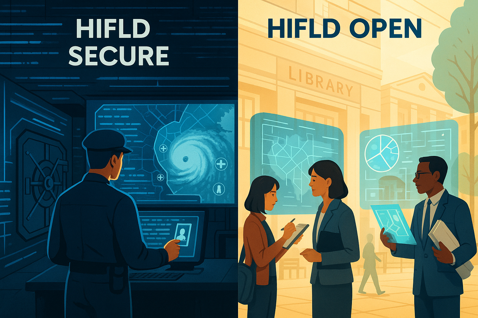
A Tale of Two Portals: The Crucial Divide Between Open and Secure
The mature HIFLD program operated through two distinct but complementary channels, each with a specific purpose and audience: HIFLD Secure and HIFLD Open. Understanding the difference between them is essential to grasping the full impact of the recent changes.
HIFLD Secure: The Inner Sanctum
HIFLD Secure is the program's restricted-access repository. It is the digital vault containing sensitive, proprietary, and controlled information essential for the core missions of the Homeland Security Enterprise (HSE). This includes commercially licensed data, such as detailed business points-of-interest from vendors like SafeGraph and parcel data from LightBox, as well as datasets marked "For Official Use Only" (FOUO). Access to HIFLD Secure is, and should be, tightly controlled. It is limited to vetted mission partners across federal, state, local, tribal, and territorial governments, as well as their contractors, who have a direct operational need and have signed a formal Data Use Agreement (DUA). This secure environment ensures that sensitive data can be shared among trusted partners for law enforcement, critical infrastructure protection, and emergency management without being exposed to the general public.
HIFLD Open: A Radical Act of Transparency
If HIFLD Secure was the inner sanctum, HIFLD Open was the public square. Its creation represented a profound philosophical shift in the government's approach to national security data. It was born from the recognition that true national resilience cannot be achieved by government agencies alone. It requires a "Whole of Nation" approach that empowers "every citizen to have an active role in our security". The launch of HIFLD Open was a deliberate move away from the old paradigm of restricted access and physical media toward a new vision of "realtime, on-demand and dynamic data available everywhere, by everyone".
This portal provided hundreds of datasets of "public domain data for community preparedness, resiliency, research, and more". It was a deliberate act of data democratization. For the first time, a small-town urban planner, a university researcher studying climate resilience, a non-profit organizing community services, or a local journalist investigating infrastructure vulnerabilities had access to the same high-quality, national-level foundational data as a federal analyst. To encourage the widest possible use, the data was made available in multiple user-friendly formats—including CSV, KML, and Shapefiles—and through modern APIs that allowed developers to integrate the data directly into their own applications.
This openness had impacts that rippled far beyond disaster response. It acted as an economic multiplier, providing the raw material for innovation. By offering free, reliable data on national infrastructure like shipping routes or alternative fueling stations, HIFLD Open lowered the barrier to entry for local governments and private businesses to conduct analyses that could spur new investments and drive economic development. The concern voiced by one user that "Fortune 500s are about to feel some real pain" following the shutdown speaks to the deep integration of this public data into the private sector's analytical workflows.
Furthermore, in an era of waning public trust, HIFLD Open served as a powerful trust-building mechanism. The White House's Police Data Initiative, aimed at using open data to build community trust, was often discussed in the same context as HIFLD, underscoring the link between transparency and legitimacy. By allowing any citizen to access and verify the same foundational data the government was using, the portal fostered accountability and a shared, fact-based understanding of national challenges. The shutdown, lamented by one observer as a denial of the taxpayers' right to "situational awareness," is therefore not just a technical change but a symbolic retreat from this principle of transparency, potentially damaging the fragile trust between citizens and their government.
The Anatomy of a Nation: Inside the Data Trove
At its zenith, the HIFLD catalog was a sprawling digital library containing hundreds of geospatial datasets that, taken together, formed a detailed anatomical chart of the United States. It was the product of a massive collaborative effort, aggregating data from a constellation of authoritative sources including Oak Ridge National Laboratory (ORNL), the U.S. Census Bureau, the Federal Communications Commission (FCC), and the U.S. Geological Survey (USGS). To ensure the integrity of this vast collection, DHS instituted the HIFLD Acceptance Review Process (HARP), a rigorous quality control system for all new and updated data submissions. The result was a single, curated, and trusted source for the nation's foundational infrastructure data, organized across numerous critical sectors.
The sheer breadth of the catalog is best understood by exploring its key thematic areas, which map the interconnected systems that sustain modern American life.
Table 1: A Glimpse into the HIFLD Data Catalog
| Category | Example Datasets | Primary Use/Significance |
|---|---|---|
| Energy | Electric Power Transmission Lines, Natural Gas Processing Plants, Oil Wells | Grid resilience analysis, identifying energy supply chain vulnerabilities, planning for power restoration. |
| Transportation | Railroad Bridges, Airports, Major Highways, Ports | Evacuation route planning, supply chain logistics, assessing damage to critical transport links. |
| Communications | Cellular Towers, Land Mobile Broadcast Towers, Antenna Structures | Understanding communication blackouts, planning for temporary cell sites, ensuring first responder comms. |
| Public Health | Hospitals, Urgent Care Facilities, Pharmacies, Dialysis Centers | Medical facility capacity planning, identifying vulnerable populations, routing medical supplies. |
| Education | Public Schools, Private Schools, Colleges & Universities, Child Care Centers | Shelter location planning, understanding daytime population density for evacuation, assessing community assets. |
| Emergency Services | Fire Stations, Local EOCs, National Shelter System Facilities | Mutual aid planning, resource allocation during disasters, coordinating multi-agency response. |

These categories represent just a fraction of the whole. The catalog also included detailed data on the human landscape, such as the locations of all places of worship, mobile home parks, and major sports venues, which are crucial for understanding population density and identifying potential mass gathering sites during an emergency. It mapped the nation's economic engine through datasets on Fortune 500 corporate headquarters and millions of individual business points, providing a granular view of commercial activity vital for economic security planning. It even contained detailed administrative and boundary data, from congressional districts and school districts to US Coast Guard Captain of the Port Zones, providing the jurisdictional framework necessary for coordinated governance and response. This comprehensive, multi-faceted collection transformed the abstract concept of "critical infrastructure" into a tangible, mappable, and analyzable reality.
More Than Just a Map: Why HIFLD Was Unique
In a world saturated with digital maps, from the consumer-facing Google Places to the crowdsourced OpenStreetMap (OSM) and the collaborative Overture Maps, it is fair to ask what made HIFLD so special. The answer lies not in its ability to simply show what is there, but in its unique combination of authority, curation, and mission-focus—qualities that distinguish it from other platforms and explain the profound impact of its closure.
Authority Over Commercial Interest: Unlike commercial platforms, HIFLD was not built to serve advertisers or consumers looking for the nearest coffee shop. Google Places, for instance, provides a vast and frequently updated database of over 200 million points of interest, but its focus is on commercial establishments and user-generated content like reviews. Its data, while comprehensive for its purpose, is governed by restrictive terms of service that limit how data can be stored and reused, often making it unsuitable and cost-prohibitive for government and research applications. HIFLD, in contrast, was built from the ground up with data from authoritative sources—the FCC's tower registry, ORNL's energy infrastructure data, the USGS's hydrography networks—specifically for the purpose of national security and emergency management. For a fire chief planning an evacuation or a FEMA analyst modeling a flood, the official, vetted location of a fire station or a hospital is non-negotiable.
Curation Over Crowdsourcing: Open-source platforms like OpenStreetMap represent a monumental achievement in collaborative, volunteer-driven mapping. In many urban areas, its accuracy can rival or even exceed that of commercial products. However, its "wiki" model means that data quality can be inconsistent and is not guaranteed. Similarly, the newer Overture Maps Foundation, a collaboration of major tech companies, aims to create reliable open map data by combining sources, including OSM, but its quality assurance is an ongoing process that relies on user feedback over time. HIFLD’s unique value proposition was its role as a national data curator. It solved the "M: drive problem" by ingesting data from dozens of official sources and subjecting them to a rigorous quality control and standardization process, ensuring that every user was working from the same, trusted playbook.
Mission-Focus Over General Use: Ultimately, HIFLD was different because its purpose was different. Its mandate was to support the nation's most critical missions: law enforcement, emergency management, and critical infrastructure protection. This singular focus guided every decision, from data acquisition to the development of the platform. While other mapping platforms are designed for a multitude of general purposes, HIFLD was purpose-built to provide the "common operational picture" essential for a coordinated, multi-agency response to a crisis. It was not just another map; it was a foundational tool of national resilience.

Data in Action: Stories from the Front Lines
The true value of HIFLD is not found in the rows and columns of its databases, but in its application during moments of crisis and in the quiet, daily work of building stronger communities. Its datasets have been instrumental in some of the most significant disaster response efforts of the last two decades and have empowered a wide range of professionals to plan for a more resilient future.
When the Storms Come: Hurricane Response
When a major hurricane threatens the United States, HIFLD becomes an indispensable tool. During the responses to Hurricanes Harvey and Irma, the program's value was so evident that DHS rapidly launched a dedicated "HIFLD for Irma" open data site to serve as the "single authoritative source of relevant data" for the thousands of users involved in the relief effort. This platform aggregated and disseminated the best available open data to support the massive mapping activities underway, enabling a coordinated response among local, state, federal, tribal, private sector, and community partners.
In the aftermath of Hurricane Maria's devastation in Puerto Rico, HIFLD data provided the crucial baseline for damage assessments. By comparing post-storm satellite imagery from NOAA with pre-storm infrastructure data from HIFLD, responders could rapidly produce geospatial damage assessments, identifying which structures were destroyed and where flooding was most severe. This allowed FEMA and other agencies to prioritize aid and begin the long road to recovery. In these chaotic, high-stakes environments, HIFLD functions as a "common language." It provides a single, trusted map that allows disparate organizations—from FEMA and the American Red Cross to local fire departments and public health officials—to coordinate their actions seamlessly, breaking down the silos that can hamper effective response. Without this common picture, responders would risk reverting to the pre-HIFLD chaos of the "M: drive problem."
Facing the Flames: Wildfire Mitigation and Response
On the nation's West Coast, where wildfire seasons are growing longer and more destructive, HIFLD provides a similar foundational role. In the wake of devastating fires like the 2018 Camp Fire in California, recovery and mitigation efforts rely heavily on understanding the complex interplay between the natural and built environments. Planners use HIFLD data on power lines, roads, and community facilities and overlay it with fire-specific data, such as historical fire perimeters and vegetation maps, to make strategic decisions about where to rebuild and how to create more fire-resilient landscapes. For example, knowing the precise location of schools, hospitals, and fire stations from HIFLD is critical for designing effective evacuation routes and pre-positioning resources before a fire starts. This integration of infrastructure and environmental data is essential for the long-term planning needed to protect communities in an era of increasing fire risk.
Beyond Disasters: Building Resilient Communities
The impact of HIFLD extends far beyond the drama of immediate disaster response. Its open data portal, in particular, has fueled a quiet revolution in academic research and urban planning, generating an immense but often unseen return on investment for the public.
For academic researchers, HIFLD Open was a game-changer. It provided free, centralized access to high-quality, national-scale data that would have otherwise taken individual research teams years and significant funding to assemble. This has enabled countless studies on topics ranging from infrastructure resilience and climate adaptation to environmental justice and public health. The FEMA Resilience Analysis and Planning Tool (RAPT), for instance, draws heavily on HIFLD for its infrastructure data layers to help local leaders assess their community's resilience challenges. The discontinuation of the open portal is a direct blow to this academic ecosystem, with one researcher on Reddit noting their surprise when the data they needed for a planning study had simply vanished.
Similarly, urban and regional planners have used HIFLD as a foundational layer for their work. Datasets on transportation networks, school district boundaries, and census statistical areas are the building blocks for creating comprehensive plans for safer, more equitable, and more sustainable communities. Whether analyzing access to public transit, siting new public facilities, or modeling urban growth, planners rely on the kind of authoritative, standardized data that HIFLD provided. Every small town that could develop a professional-grade evacuation plan without hiring expensive consultants, and every academic study that advanced our understanding of community resilience, represents a massive societal benefit that far outweighs the modest cost of maintaining a public data portal.
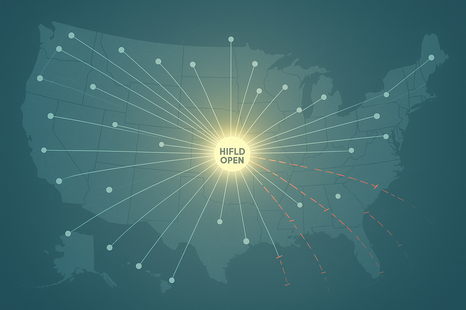
The Digital Door Slams Shut: The End of an Open Era
On June 26, 2025, the updates to HIFLD Open stopped. Two months later, on August 26, the portal was officially discontinued. The official explanation from DHS was stark in its brevity: hosting the site and providing public domain data for "community preparedness, resiliency, research, and more" was no longer a priority for their mission. For the thousands of users who had come to depend on this resource, the decision felt like a sudden and inexplicable reversal of the "Whole of Nation" philosophy that DHS itself had once championed.
The reaction from the geospatial and emergency management communities was a mixture of shock, confusion, and frustration. On professional forums like Reddit's r/gis, the announcement was met with dismay. "This is crazy," one user wrote. "I feel like most major employers are currently using it... The Fortune 500s are about to feel some real pain... Anyone else hyperventilating?". Another user, whose work on a green energy project was disrupted when a HIFLD link suddenly went dead, captured the practical consequences of the shutdown. The sentiment was perhaps best summarized by a user who lamented, "I guess taxpayers don't deserve situational awareness". This raw, emotional response from the front lines of data analysis underscores the deep sense of loss and betrayal felt by a community that saw HIFLD Open as a vital public utility.
As a replacement, DHS offered users a "crosswalk" document—essentially a spreadsheet with links to the original data sources at various other federal agencies. While presented as a solution, this approach is seen by many users as a significant step backward. It effectively dismantles the single greatest value proposition of HIFLD: its role as a centralized, curated, and standardized repository. Instead of a one-stop shop, users are now forced to become digital detectives, hunting for data across dozens of disparate agency websites, each with its own data formats, update cycles, metadata standards, and quality control—or lack thereof. It is a return to the very "M: drive problem" of data chaos that HIFLD was created to solve over two decades ago. Furthermore, a closer look at the crosswalk reveals that a significant portion of the data is not being redirected but simply moved behind the wall of HIFLD Secure, rendering it permanently inaccessible to the public, academics, and the private sector.
The community's lack of faith in this new, decentralized model is evidenced by the immediate, grassroots scramble to preserve the data before it vanished. A "Data Rescue Project" was coordinated among GIS professionals to download and host copies of the datasets elsewhere. One Reddit user took it upon themselves to spend two days personally crawling and archiving over 300 of the data layers to a public Google Drive, stating, "This entire situation is unclear and non-transparent. I figured that by archiving it, better safe than sorry". This desperate, ad-hoc archival effort is a powerful testament to the data's perceived value and a stark indictment of the decision to dismantle the public infrastructure that housed it. The shutdown of HIFLD Open serves as a sobering lesson in the fragility of our digital public goods. Unlike a physical bridge or a library, a vital national data portal can be decommissioned with little public debate or recourse, revealing a critical blind spot in how we govern and protect the shared data assets of the 21st century.
The Echo of an Open Map
In a thoughtful reflection on the shutdown, Bill Dollins, one of the program's earliest contributors, noted that the public-facing HIFLD Open was always considered a "nice to have" from the perspective of the core homeland security mission, which continues unabated within the confines of HIFLD Secure. From a narrow, mission-focused viewpoint, he is correct. The lights are still on for the official first responders and federal analysts who have access to the secure portal. The nation's most essential missions will continue to be supported by high-quality, relevant data.
However, the story of HIFLD Open demonstrates that this "nice to have" was, in fact, a revolutionary public good with profound and far-reaching value. Its closure represents a tangible loss on multiple fronts. It is a loss for economic innovation, as businesses and entrepreneurs lose access to a free, foundational dataset that spurred development. It is a loss for academic and scientific research, as scholars now face higher barriers to studying the critical issues of our time, from climate resilience to social equity. It is a loss for local governments and community planners, who are now forced to expend precious resources hunting for data that was once easily accessible. And it is a loss for government transparency, eroding the public trust that is built when citizens and their government can work from a shared set of facts.
The decision to shutter HIFLD Open reflects a fundamental misunderstanding of where national resilience truly comes from. It does not reside solely within the walls of federal agencies. It is built in city planning departments, in university research labs, in non-profit boardrooms, and in the informed actions of a prepared citizenry. For a brief and brilliant period, HIFLD Open was the tool that connected all these efforts. It was the people's map.
The core work of HIFLD will endure, a testament to the vision of its creators. But the echo of the open portal will linger as a cautionary tale. It reminds us that progress in the digital public square is not guaranteed and that the infrastructure of our shared knowledge is fragile. The story of HIFLD Open's rise and fall leaves us with a critical question for the years ahead: having seen the immense power of a truly open and common map, what will it take to build the next one, and how will we ensure it remains open to all?
-
NGA transfers Homeland Security Infrastructure Program to DHS, accessed August 27, 2025, https://www.nga.mil/news/NGA_transfers_Homeland_Security_Infrastructure_Pro.html
DHS Launches 2nd Dedicated Open Data Site for Hurricane Support - Esri Community, accessed August 27, 2025, https://community.esri.com/t5/public-safety-blog/dhs-launches-2nd-dedicated-open-data-site-for/ba-p/887810
Mapping Your Infrastructure: Datasets for Infrastructure Identification | CISA, accessed August 27, 2025, https://www.cisa.gov/resources-tools/resources/mapping-your-infrastructure-datasets-infrastructure-identification
Homeland Infrastructure Foundation-Level Data (HIFLD), accessed August 27, 2025, https://www.dhs.gov/gmo/hifld
HIFLD, accessed August 27, 2025, https://hifld-geoplatform.hub.arcgis.com/
HIFLD Open, accessed August 27, 2025, https://hifld-geoplatform.hub.arcgis.com/pages/a6a99fd33af64ed9bc51e55760123a82
What happened to DHS' HIFLD data? : r/gis - Reddit, accessed August 27, 2025, https://www.reddit.com/r/gis/comments/1bcx4vj/what_happened_to_dhs_hifld_data/
Sad news: HIFLD Open to be discontinued by Sept. 30, 2025. : r/gis - Reddit, accessed August 27, 2025, https://www.reddit.com/r/gis/comments/1lkol3s/sad_news_hifld_open_to_be_discontinued_by_sept_30/
Dataset - HIFLD - ArcGIS Online, accessed August 27, 2025, https://hifld-geoplatform.hub.arcgis.com/search?tags=structure
In HIFLD, a Lesson - geoMusings, accessed August 27, 2025, https://blog.geomusings.com/2024/02/15/in-hifld-a-lesson/
HIFLD Open Is Dead*, Long Live HIFLD - geoMusings, accessed August 27, 2025, https://blog.geomusings.com/2025/07/02/hifld-open-is-dead-long-live-hifld/
Homeland Infrastructure Foundation Level Data (HIFLD) Open Data | ArcGIS Hub, accessed August 27, 2025, https://hub.arcgis.com/documents/edc::homeland-infrastructure-foundation-level-data-hifld-open-data/about
HIFLD User Forum Part 1 of 3 - November 1 2023 | Homeland Security, accessed August 27, 2025, https://www.dhs.gov/medialibrary/assets/video/50519
Geospatial Management Office (GMO) | Homeland Security, accessed August 27, 2025, https://www.dhs.gov/geospatial-management-office-gmo
Secure | HIFLD Catalog Viewer - ArcGIS Experience Builder, accessed August 27, 2025, https://experience.arcgis.com/experience/2dedf7da18254d75b562cc51ba3a1653/page/Secure
Contact - HIFLD, accessed August 27, 2025, https://hifld-geoplatform.hub.arcgis.com/pages/contact
DHS HIFLD Open: Open Data for Economic Resiliency - Esri, accessed August 27, 2025, https://www.esri.com/about/newsroom/insider/open-data-for-economic-resiliency
DHS HIFLD Open: Open Data for Economic Resiliency - Esri, accessed August 27, 2025, https://www.esri.com/about/newsroom/insider/open-data-for-economic-resiliency/
HIFLD Open, accessed August 27, 2025, https://hifld-geoplatform.hub.arcgis.com/pages/hifld-open
Homeland Infrastructure Foundation-Level Data (HIFLD) - ChucktownFloods, accessed August 27, 2025, https://chucktownfloods.cofc.edu/data-sources/homeland-infrastructure-foundation-level-data-hifld/
How Big Data is Keeping Your Communities Safe - GovLoop, accessed August 27, 2025, https://www.govloop.com/big-data-keeping-communities-safe/
HIFLD Open Data - International Association of Fire Chiefs, accessed August 27, 2025, https://www.iafc.org/topics-and-tools/resources/resource/hifld-open-data
Geospatial Data Sets | ORNL, accessed August 27, 2025, https://www.ornl.gov/project/geospatial-data-sets
hifld - Dataset - Catalog - Data.gov, accessed August 27, 2025, https://catalog.data.gov/dataset?publisher=HIFLD
Dataset - HIFLD - ArcGIS Online, accessed August 27, 2025, https://hifld-geoplatform.hub.arcgis.com/search?layout=grid&tags=infrastructure
Dataset - HIFLD - ArcGIS Online, accessed August 27, 2025, https://hifld-geoplatform.hub.arcgis.com/search?categories=hifld
GeoPlatform ArcGIS Online - HIFLD, accessed August 27, 2025, https://hifld-geoplatform.hub.arcgis.com/search?tags=feature%20service
Colleges and Universities - HIFLD - ArcGIS Online, accessed August 27, 2025, https://hifld-geoplatform.hub.arcgis.com/datasets/geoplatform::colleges-and-universities/about
Dataset - HIFLD - ArcGIS Online, accessed August 27, 2025, https://hifld-geoplatform.hub.arcgis.com/search?groupIds=c8d9db693a95479e80758ef9cd778d5e
Dataset - HIFLD - ArcGIS Online, accessed August 27, 2025, https://hifld-geoplatform.hub.arcgis.com/search?groupIds=f16c582f00184cb094affff556fe57ee
Damage Assessments – Hurricane Maria | Disasters, accessed August 27, 2025, https://disasters-geoplatform.hub.arcgis.com/pages/damage-assessments-hurricane-maria
FEMA P-2020 Mitigation Assessment Team Report - Hurricanes Irma and Maria in Puerto Rico, accessed August 27, 2025, https://www.fema.gov/sites/default/files/2020-07/mat-report_hurricane-irma-maria-puerto-rico_2.pdf
Homeland Infrastructure Foundation Level Data (HIFLD) Working Group - RIGIS, accessed August 27, 2025, http://data.rigis.org/assets/docs/Usergroup_Presentations/20120814/20120814-JBarrett-HIFLD%20HSIP%202012%20RIGIS.pdf
Dataset - HIFLD - ArcGIS Online, accessed August 27, 2025, https://hifld-geoplatform.hub.arcgis.com/search?collection=dataset&layout=grid&tags=fire
Wildfire Restoration: Mapping a Climate-Resilient Camp Fire Recovery Plan - Esri, accessed August 27, 2025, https://www.esri.com/about/newsroom/blog/mapping-climate-resilient-camp-fire-recovery-plan
Community Wildfire Protection Ordinance - LA County Planning, accessed August 27, 2025, https://planning.lacounty.gov/long-range-planning/community-wildfire-protection-ordinance/
The Homeland Infrastructure Foundation-Level Data (HIFLD) - Nicholas Institute, accessed August 27, 2025, https://nicholasinstitute.duke.edu/energy-data-resources/homeland-infrastructure-foundation-level-data-hifld
Resilience Analysis and Planning Tool (RAPT): Data Layers and Sources - FEMA.gov, accessed August 27, 2025, https://www.fema.gov/sites/default/files/documents/fema_data-layers-and-sources_01-2021.pdf
Dataset - HIFLD - ArcGIS Online, accessed August 27, 2025, https://hifld-geoplatform.hub.arcgis.com/search?groupIds=e5cf7f3805274fef90100ab704ee2ac1
(PDF) APPLICATIONS OF GIS AND URBAN DATA ANALYTICS TO LAND USE PLANNING, accessed August 27, 2025, https://www.researchgate.net/publication/379407915_APPLICATIONS_OF_GIS_AND_URBAN_DATA_ANALYTICS_TO_LAND_USE_PLANNING
HIFLD Open to be discontinued by Sept. 30, 2025 - NAPSG Foundation, accessed August 27, 2025, https://www.napsgfoundation.org/hifld_open/
HIFLD Open GIS Portal Shuts Down Aug 26 2025 - At These Coordinates, accessed August 27, 2025, https://atcoordinates.info/2025/08/08/hifld-open-gis-portal-shuts-down-aug-26-2025/
300+ HIFLD Datasets Archived : r/gis - Reddit, accessed August 27, 2025, https://www.reddit.com/r/gis/comments/1mzu4np/300_hifld_datasets_archived/