


GEOSPATIAL FRONTIERS
A Publication by Project Geospatial
LOOKING BEYOND
THE MAP
Geospatial Frontiers, a new publication from Project Geospatial, brings together leading voices and experts from across the geospatial ecosystem to tackle the industry's most pressing challenges. Through in-depth articles and discussions, Geospatial Frontiers aims to explore innovative solutions and spark critical conversations that will shape the future of geospatial technology and its applications.
CONTRIBUTING AUTHORS

Adam Simmons

Keith Barber

Fred Woods

Matthew Husted

Chris Vaughan
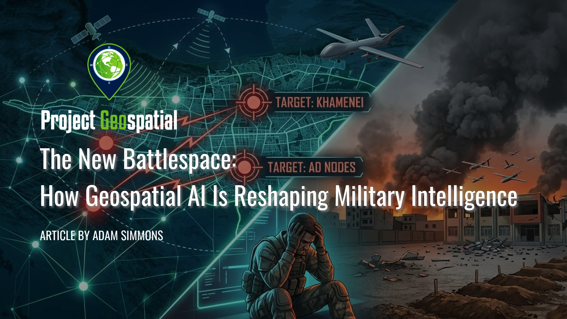
The New Battlespace: How Geospatial AI Is Reshaping Military Intelligence
The 2026 conflict in Iran marks a terrifying turning point in military history: the birth of the algorithmic battlespace. Through Operation Epic Fury, the United States and Israel have deployed a "kill web" driven by Geospatial AI, compressing decision-making from weeks to mere seconds. While systems like Project Maven and autonomous drone swarms offer unprecedented tactical precision, the human cost remains devastatingly high, evidenced by the tragic Minab school bombing and the growing psychological toll on remote operators. As Silicon Valley giants like Anthropic and Palantir clash over the ethics of AI-driven warfare, the world faces a fractured global economy and a new reality where machine-speed violence outpaces human thought.

Wireless Sensor Network Resilience in Spectrum-Denied Battlespaces
The era of U.S. electromagnetic spectrum dominance has ended, replaced by contested battlespaces where adversaries like Russia and China employ advanced electronic warfare (EW) to deny critical communications and disable up to 90 percent of standard sensor networks. This new reality demands a fundamental paradigm shift in the design of Wireless Sensor Networks (WSNs) and unattended ground sensors (UGS), moving away from systems built for permissive environments toward resilient architectures optimized for spectrum-denied operations. To ensure network persistence under extreme degradation, future military strategy must embrace self-healing mesh networks that utilize edge AI/ML for real-time jamming detection, advanced Counter EW (CEW) techniques like frequency agility, and operational adaptations such as passive acoustic sensors that emit no signals.

Wireless Sensor Networks: The Missing Link in Modern Intelligence
Mature Wireless Sensor Networks (WSNs), or "motes," are the missing link in modern intelligence and ISR operations. This article argues the intelligence community's failure to adopt this mature technology is a critical strategic lapse , creating a "static-data trap". Discover why the problem isn't the technology but institutional lag , and explore a framework for integrating WSNs with COTS GEOINT platforms to finally achieve continuous, real-time situational awareness.