
EXPLORE THE GEOSPATIAL INDUSTRY THROUGH THE VISIONS OF THOSE INVOLVED…

GEOINT 2022 - Magadia Consulting Inc
Magadia Consulting is dedicated to providing a level of service that is unparalleled in todays' demanding technological marketplace. Their teams of specialists help businesses stay ahead of the curve by overcoming their IT challenges, delivering flexible & project-based managed solutions, and staff augmentation services. One of Magadia's founding principles is to deliver quality systems quickly. They achieve this through a commitment to excellence that is shared by every Magadia professional.
From Magadia Consulting Inc we spoke with Debra Wickert, Leroy Burney, and Mark David Jones to discuss their speciality in consulting on IT work and their own unique experiences that bring to their customers. They reviewed their favorite technology from the symposium and new positive trends they’ve noticed along with the obstacles they see coming around the corner.

GEOINT 2022 - C3AI - Andrew Heft
C3 AI provides over 40 turnkey Enterprise AI applications that meet the business-critical needs of global enterprises in manufacturing, financial services, government, utilities, oil and gas, chemicals, agribusiness, defense and intelligence, and more.
Andrew Hoeft, the Senior Director of Strategic Solutions for C3.ai discusses their products that work through entire data fusion lifecycle, from any source data to transformation. He explains how that can work with virtually any type of data from free text to full motion video and get that data into a state that AI models can be applied to. With many possible use cases, C3.ai can get a production environment spun up in a matter of weeks and begin making mission impact and adding value in a matter of weeks

GEOINT 2022 - Orbital Insight - Kevin O'Brien
Orbital Insight is the leader in geospatial analytics and location intelligence that helps organizations understand what’s happening on and to the Earth. Orbital Insight uses AI to answer their questions about supply chains, global commodities, geopolitical events, demographics and national security using multiple sources of geospatial data—including satellite images, mobile location, connected cars and other IoT data. Armed with this insight, organizations can anticipate future changes to avoid costly surprises and create new opportunities.
Kevin O’Brien, CEO of Orbital Insights, met up with us at GEOINT 2022 to discuss their subscription model analytics service. He elaborated on the importance of fusing sensors with the geospatial data. The aggregation of this data is key in crucial use cases for many different industries such as banking, agriculture, and energy companies. He also went on to explain the growth opportunities he sees coming for Orbital Insights and the industry as a whole in the next five years.

GEOINT 2022 - Pixxel - Aakash Parekh
Pixxel is a space technology company working towards creating the world's highest resolution hyperspectral imaging satellite-imaging constellation. The images gathered by Pixxel's satellites will provide up-to-date information relevant to climate monitoring, crop yield prediction, urban planning, and disaster response.
Pixxel’s Aakash Parekh discusses the importance of hyperspectral data in the industry to unlock crucial information across the spectrum. Their 5 meter hyperspectral constellation aims to gain global coverage with a daily revisit. He explains their business model and how customers are able to gain access to their data. Aakash continued on to describe the critical use cases that hyperspectral data excels at compared to other sources.

GEOINT 2022 - Asterra - Elly Perets & James Perry
ASTERRA (formerly) Utilis provides data-driven solutions for water utilities, government agencies and the greater infrastructure industry in the areas of roads, rails, dams, and mines. The company’s proprietary algorithms and highly educated scientists and engineers are the key to their mission, to deliver actionable intelligence to advance Earth’s resource resilience. Since 2017, ASTERRA technology has been used in over 59 countries, saving over 169,280 million gallons of potable water, reducing carbon dioxide emissions by 108,339 metric tons, and saving 423,200 MWH of energy, all in support of United Nations Sustainable Development Goals. ASTERRA is headquartered in Israel with offices in the United States, United Kingdom, and Japan. Their innovative data solutions are used in multiple verticals around the globe. ASTERRA is investing in artificial intelligence (AI) to bring their products to the next level.
Elly Perets, the CEO of ASTERRA, and James Perry, ASTERRA’s Executive Vice President for the America’s Region, describe how their company identifies infrastructure failures and how they plan to expand to other opportunities in various sectors. Elly discusses the urgent need for infrastructure failure detection and the short comings of the current solutions.

GEOINT 2022 - Rendered.AI - Nathan Kundtz
Rendered.ai is a platform-as-a-service for data scientists, data engineers, and developers who need to create and deploy unlimited, customized synthetic data generation for machine learning and artificial intelligence workflows, reducing expense, closing gaps, and overcoming bias, security, and privacy issues when compared with the use or acquisition of real-world data.
Nathan Kundtz, CEO of Rendered.ai, discusses the importance and need for synthetic data and the specific challenges it solves, particularly in the GEOINT community. He goes on to address the negative stereotypes of synthetic data and the successes that can be achieved with it. He describes the different types of imagery data they have been able to produce including SAR, infrared, and even hyperspectral. He also explores the obstacles the industry still needs to address in regards to AI and ML in the industry.

GEOINT 2022 - HySpecIQ - Dr. Katie Salvaggio
With plans to launch its first series of LEO constellations in 2023, HySpecIQ is positioned to become the world’s leading provider of airborne quality hyperspectral imagery and analytics from space. Their vision is to empower the most prominent intelligence, defense, and industry decision makers with insights and analytics to make safer, smarter, stronger, and more sustainable decisions.
Dr. Katie Salvaggio, with HySpecIq, explains the value of hyperspectral imagery as compared to other spectral imagery. She explains what drew her to work with hyperspectral imagery in particular and the unique proposition their data will provide to their customers.

GEOINT 2022 - Cesium - Brady Moore
At the core of Cesium’s mission is to advance 3D geospatial through openness, community, and collaborations. Cesium is an open platform for creating 3D applications that are fast, flexible, and based on real-world geospatial data.
Brady Moore, Director of Mission Support with Cesium, describes their applications for geospatial visualization. He demonstrates their 3D Tiles Next software and how it helps expose metadata at runtime. Brady also discusses the specific use cases that this software can enhance. Their other demonstration of CesiumJS shows the software’s ability to create virtual 3D models from open source data.

GEOINT 2022 - Civil Applications Committee - Dan Opstal & Scott Kaplan
The interagency Civil Applications Committee (CAC) facilitates the appropriate civil uses of overhead remote sensing technologies and data collected by military and intelligence capabilities, including from commercial sources. The CAC is operated and staffed by the U.S. Geological Survey on behalf of the U.S. Department of the Interior and its interagency partners. The director of the U.S. Geological Survey is the chair of the committee, and the vice-chair is a non-Department of the Interior senior official. The CAC ensures certain Federal civil agencies have access to these remotely sensed assets to meet their statutory missions in ways that do not threaten the civil rights, civil liberties, and personal privacy of U.S. citizens. To meets its mandate, the CAC hosts various working groups and communities of interest including those focused on thermal issues (wildland fires and volcanoes), environmental security, and historical satellite imagery.
Dan Opstal and Scott Kaplan, with the Civil Applications Committee, discuss the importance of CAC and why having an organization such as this is so important to the community as a whole. They also describe how they are educating individuals and their partners about how CAC can help in their particular missions. Dan also explains some of the challenges in the industry they are trying to mitigate in the industry such as accessibility to data. Scott also went on to elaborate on the need for improved communication between disciplines and how CAC is trying to help with that.

GEOINT 2022 - NGA - Rob Shields
Anyone who sails a ship, flies an aircraft, goes into harm’s way, makes national policy decisions, responds to disasters, or navigates with a cellphone, all rely on the National Geospatial-Intelligence Agency. NGA delivers world-class geospatial intelligence, or GEOINT, that provides a decisive advantage to warfighters, policymakers, intelligence professionals and first responders. Both an intelligence agency and a combat support agency, NGA fulfills the president’s national security priorities in partnership with the intelligence community and Department of Defense.
Rob Shields, the Director of Analytic Technologies at the NGA, talks about the technology they develop to support the analysts. As part of the office that provides the needs and prioritizes the solutions they need from providers, he discusses the types of tools that analysts prefer. He also describes the change he’s seen in the culture with the recent emphasis placed on the collaboration and innovation at the Moonshot Labs.
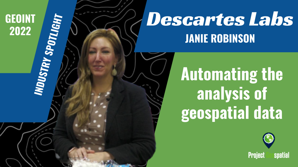
GEOINT 2022 - Descartes Labs Gov - Janie Robinson
Descartes Labs is a technology company that automates the analysis of geospatial data to help organizations answer key questions about the physical world. Through our SaaS platform, they enable the analysis of earth observation data at scale, providing services and solutions across commodity sourcing and forecasting, resource exploration, and climate resilience, while also supporting diverse federal government efforts to gather, analyze, and provide actionable insights from geospatial data.
Descartes Labs Government’s President, Janie Robinson, describes the value of Descartes Labs’ government subsidiary and the work they do. She explains the new products and services they are offering, including helping the government utilize open source and commercially available data. Their ability to work with a variety of data types and run analytics is highly impactful and works to solve the hurdles in trusting machine learning in the industry.

GEOINT 2022 - Satellogic - Ryan McKinney & Thomas VanMatre
Satellogic is a leading provider of high resolution satellite imagery. They drive real outcomes for our customers with daily, actionable, planetary-scale insights you can trust. Their low-Earth-orbit satellite constellation and product platform deliver geospatial data at the right cost, making Earth Observation data accessible and affordable to enable better global decision-making. With more than 200 satellite engineers, operators and product specialists, they are on a mission to deliver a fundamentally better picture of our planet and the many forces that reshape it every day. They bring space down to earth for large enterprises and governments of all sizes who need to see for themselves how our world is changing.
Ryan McKinney, Vice President and General Manager for Satellogic North America, and Thomas VanMatre, Vice President of Global Business Development, discuss what products and services they provide including their multispectral and hyperspectral data. They also discuss how their business model works towards their goal of democratizing access to imagery.

GEOINT 2022 - NGA - Tim Clayton and Rick Myllenbeck
Anyone who sails a ship, flies an aircraft, goes into harm’s way, makes national policy decisions, responds to disasters, or navigates with a cellphone, all rely on the National Geospatial-Intelligence Agency. NGA delivers world-class geospatial intelligence, or GEOINT, that provides a decisive advantage to warfighters, policymakers, intelligence professionals and first responders. Both an intelligence agency and a combat support agency, NGA fulfills the president’s national security priorities in partnership with the intelligence community and Department of Defense.
Tim Clayton, Director of Acquisition Oversight at the NGA, and Rick Myllenbeck, Industry Engagement Advisor at the NGA, discuss industry engagement and the procurement workflow at the agency. They touch on the best way for industry to work with government and the major mistakes the companies often make when working with government. Diving deeper, they explain the best way for small business to engage with the NGA and their relationship of with the Small Business Office.

GEOINT 2022 - NGA - Gary Dunow
Anyone who sails a ship, flies an aircraft, goes into harm’s way, makes national policy decisions, responds to disasters, or navigates with a cellphone, all rely on the National Geospatial-Intelligence Agency. NGA delivers world-class geospatial intelligence, or GEOINT, that provides a decisive advantage to warfighters, policymakers, intelligence professionals and first responders. Both an intelligence agency and a combat support agency, NGA fulfills the president’s national security priorities in partnership with the intelligence community and Department of Defense.
Gary Dunow, the Associate Director of Enterprise at the NGA, discusses the agency’s priorities and what he would like to see be the focus for the coming five years. The three main targets he explains are an interoperable GEOINT environment, sensor to effect capabilities, and GEOINT superiority from space. And he went on to elaborate on how he plans to coordinate with NGA’s industry partners to achieve their goals.

GEOINT 2022 - Gitlab - Marc Kriz
GitLab is a complete DevOps platform, delivered as a single application, fundamentally changing the way Development, Security, and Ops teams collaborate and build software. From idea to production, GitLab helps teams improve cycle time from weeks to minutes, reduce development costs and time to market while increasing developer productivity.
Marc Kriz, a Strategic Account Leader with GitLab, discusses the work his National Security Programs group does with government organizations. Their single end-to-end DevSecOps platform is key to developing software both quickly and securely. With remote work becoming more and more common, even in the intelligence community, GitLab is building tools to mitigate many of the challenges that come with that shift.

GEOINT 2022 - ESRI GeoAnalytics Engine - Stuart Penninger
As a leading location intelligence platform provider (Forrester Wave 2020), Esri empowers leaders with innovative tools to help create sustainable prosperity. Esri's customers drive digital transformation by embracing the power of location,
Stuart Penninger, a Solution Engineer at Esri, tells us about the ArcGIS GeoAnalytics Engine. He discusses how their tool allows users to access massive amounts of data from virtually anywhere. His demonstration walks us through an analyst’s workflow and emphasizes the speed and ease-of-use of their system and how impactful it is for analysts in the industry. He also explains the skillsets needed to work with the application and the learning curve users may face.

GEOINT 2022 - Cognitive Space - Scott Herman
Cognitive Space is an AI-driven solution for near real-time dynamic mission management, collection planning & optimization, and revenue/performance capacity forecasting. Through space, we can monitor a changing planet, protect national interests, provide real-time communications, and enable a web of globally connected devices. It also offers the means for human civilization to scale beyond the bounds of our planet. For the vision of space to reach its fullest potential, the traditional approach of operating satellites individually will not suffice; they must be orchestrated at scale. By leveraging modern AI, cloud, and blockchain technology, Cognitive Space will orchestrate this new space domain to bring about the future we envision.
Scott Herman, with Cognitive Space, describes the problems and challenges they solve for their customers including mission management, collection planning, order management, and more. He describes the benefits of starting with Moonshot Labs and the process of participating in various other accelerators. Scott then goes on to discuss what is around the corner for Cognitive Space and the future challenges of machine orchestration.

GEOINT 2022 - Adobe - John Lewington
Adobe is the global leader in digital media and digital marketing solutions. Their creative, marketing and document solutions empower everyone – from emerging artists to governments and global brands – to bring digital creations to life and deliver immersive, compelling experiences to the right person at the right moment for the best results. In short, Adobe is everywhere, and we’re changing the world through digital experiences.
Adobe’s Industry Specialist, Jon Lewington, sat down with us to discuss the 3D modeling tools they recently announced and their new focus on the metaverse. He discusses what the metaverse means for the GEOINT community and how the merging of the physical and virtual worlds can make drastic shifts in the industry. Jon addresses the needs and problems of their customers that they are trying to serve with this new focus as well.

GEOINT 2022 - Kleos - Peter Round & Guillermo Gutiérrez
With the creation of distributed sensing and intelligence gathering capability, the Kleos satellites exploit rapidly deployed technologies to reduce risk and ensure that changing customer needs are fulfilled proactively by small, low cost satellites. Their engineers utilise propriety algorithms and data processing methodologies to ensure their unique data products can be used in conjunction with other data sources, mapping or GEOINT imagery to enhance the identification of dark maritime and land-based activity.
Peter Round and Guillermoe Gutiérrez, with Kleos, explain their unique services and why they choose to focus on the engineering and improvement on their constellation rather than analytics. They discuss the challenges facing the RF data industry and benefits of using that data.

GEOINT 2022 - Hydrosat - Peter Fossel
Hydrosat provides daily, high-resolution thermal and multispectral infrared imagery of the entire Earth. Thermal allows you to visualize heat and reveal unseen truths that visual imagery can’t detect. Leveraging their first-in-history thermal capabilities, they also provide analytics solutions to solve climate and agriculture issues.
Hydrosat’s Co-Founder and CEO, Peter Fossel, sat down with Adam with talk about their upcoming launch of their first satellite. He went on to discuss why they chose to focus specifically on infrared as opposed to other parts of the spectrum, such as visible or SAR. Their sub field level resolution helps them get a clearer snapshot than even Landsat which sits at about 120 meters per pixel. And their always-on monitoring eliminates the need for tasking and allows users to access data from any time slot.